DataMonkey: GeoAI to Combine In-House with Public Map-Based Data
In a world where information moves at lightning speed and decisions need to be made quicker than a coffee break, there is one tool that's turning heads and reshuffling the way businesses think about data: DataMonkey's GeoAI. The conundrum of harnessing the vast array of map-based data without advanced coding or data skills has been, for many, a mountainous task. But what if you could leap over that mountain in a single bound, making reliable and location-based decisions that are not just quick, but immensely fun and engaging? Let’s dive into how DataMonkey is shaking things up, blending both public and in-house data seamlessly.
The New Age of Map-Based Data
Map-based data has exploded in recent years. From basic geographical information to complex demographic and environmental data, the layers are many, and the insights they offer are profound. Businesses can no longer afford to sit idly by, not making the most of these resources. Yet, the barrier to entry — complex data manipulation and coding — deters many.
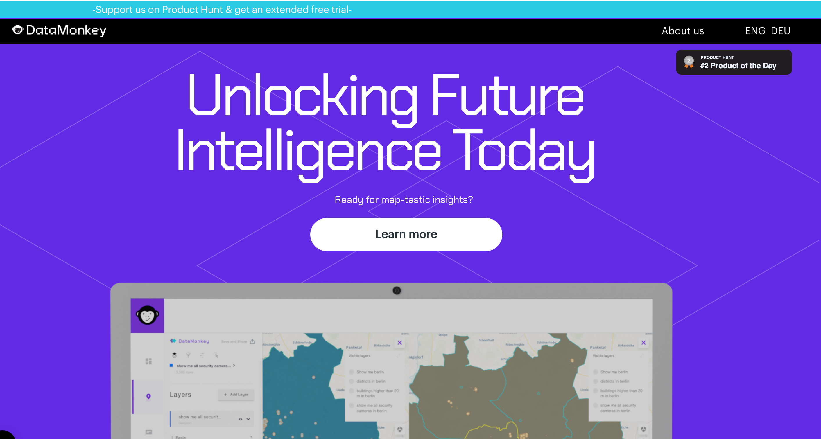
Enter GeoAI, a game-changer in the world of map-based analytics. Developed by DataMonkey, GeoAI simplifies the process of adding context and comprehension to public geo data. Users can merge internal proprietary datasets with those from the public domain using nothing more than natural language processing. No technical expertise is needed, just your curiosity and questions that need answering.
Breaking Down GeoAI's Advanced Capabilities
- Natural Language Processing: An Intuitive ApproachGeoAI eliminates the jargon-filled and intimidating interface of traditional data analytics, breathing life into the user experience with natural language processing. This allows users to interact with their data intuitively. Gone are the days when you’d need a data scientist or a code interpreter just to pull a report or map.
Imagine wanting to compare foot traffic in various parts of the city where your retail stores are located. You could simply input "Compare foot traffic in City Center vs. Suburb A in October" and voila, your data is laid out in a comprehensible, visual format ready for action.
- Seamless Integration with Public Data SourcesThe integration capability of GeoAI is what makes it particularly powerful. By marrying in-house data with extensive public datasets like traffic analysis, weather patterns, socio-economic factors, and even satellite imagery, the tool transforms what could be a simple number crunching exercise into a strategic intelligence gathering session.
Consider a real estate company deciding where to invest in new properties. By incorporating public map-based data — like land value, transport facilities, crime rates, and school ratings — into their private portfolio data, they gain a comprehensive understanding of potential opportunities.
- Real-Time Insights and Decision MakingSpeed is king in today's market landscape. With real-time analytics, GeoAI delivers insights almost instantaneously, giving businesses the agility to pivot quickly in response to market changes. Whether it’s adjusting supply chain routes due to unexpected weather events or recalibrating marketing strategies based on demographic shifts, the immediacy of GeoAI insights is second to none.
Why Businesses Should Adopt GeoAI Now
-
Democratizing Data AccessThe days when only tech giants and industry behemoths could afford complex data analysis are over. DataMonkey’s GeoAI has democratized access, meaning small businesses and individual entrepreneurs can now tap into the same powerful insights as the big guns. This levels the playing field and prompts innovation across the board.
-
Cost EfficiencyBuilding a dedicated team to handle map-based analytics is costly. Between the salaries for skilled employees and the expenditures on complex software tools, costs can spiral out of control quickly. GeoAI eliminates these expenses, providing a cost-effective alternative that doesn't skimp on capability or quality.
-
Enhanced Collaboration Across TeamsA major benefit of GeoAI is that it breaks down silos within organizations. Teams across different functions can access the same datasets and insights, facilitating collaboration and cohesive decision-making. Marketing, logistics, operations, and customer services can all consult GeoAI-derived insights for unified strategies.
Challenges Ahead: Addressing the Roadblocks
As transformative as GeoAI sounds, there are challenges and potential roadblocks businesses must be mindful of. For instance, ensuring data privacy while integrating proprietary data with public datasets is crucial. With cyber threats on the rise, maintaining secure data environments is paramount.
Moreover, while GeoAI promises an intuitive user interface, training and familiarization are still essential to maximize its capabilities. Users need to be adequately educated about how to frame queries and interpret data outputs effectively.
Conclusion: Embrace the Excitement
In conclusion, the introduction of DataMonkey's GeoAI changes the landscape of how businesses approach map-based data. By making it accessible, engaging, and significantly easier to use, organizations can unlock new value and form strategic strongholds in their respective fields. Consider this tool not just an asset but a catalyst for industry transformation. So, dive right in, and let your data lead the way to smarter decisions!