Notes on Municipalities and Attractions in Palawan, Philippines
Notes on Local Municipalities in Palawan, Philippines

La Estrella Del Norte
- Location: Sampaloc Street, Narra, Palawan, Philippines
- Meaning: "La Estrella Del Norte" translates to "The Star of the North."
- Significance: This municipality is one of the oldest in Palawan, highlighting its historical importance. It is known as the "Tiger Municipality of Palawan" due to its natural resources, emphasizing the economic potential derived from these resources.
- Economic Role: Described as the "Rice Granary of Palawan," it plays a crucial role in rice production, supporting local agriculture.
Honda Bay
- Location: Puerto Princesa 5300, Palawan, Philippines
- Description: Situated on the eastern shores of Palawan, Honda Bay is known for its dual function: supporting both commercial fisheries and recreational activities.
- Importance: Its dual nature suggests a balance between resource exploitation and recreation, promoting sustainable development.
Dumaran Island
- Location: Dumaran, Palawan, Philippines
- Municipality Status: A third-class municipality, demonstrating varying levels of economic and infrastructure development.
- Population: Home to approximately 23,000 residents according to the 2015 census, indicating a small but established community.
- Geographical Note: Covers the southern part of Dumaran Island, an essential detail for understanding its geographical context.
Puerto Princesa Island
- Location: Puerto Princesa, Palawan, Philippines
- Recognition: Known as the "cleanest and greenest city" and recognized globally for its excellence in environmental sustainability.
- Conclusion: This status enhances its appeal as a tourist destination, highlighting the importance of environmental stewardship.
El Nido's Bacuit Bay
- Location: El Nido, Palawan, Philippines
- Tourist Appeal: Famous for its pristine beaches, Bacuit Bay is considered a prime attraction in Palawan.
- Economic Impact: Tourism in this area significantly boosts the local economy, showcasing the economic benefits derived from natural beauty and biodiversity.
| Municipality | Location | Description |
|---|---|---|
| La Estrella Del Norte | Narra, Palawan, Philippines | Known as "The Star of the North"; oldest municipality; "Tiger Municipality of Palawan"; "Rice Granary of Palawan." |
| Honda Bay | Puerto Princesa, Palawan, Philippines | Eastern shores of Palawan; utilized for subsistence and commercial fisheries; recreation. |
| Dumaran Island | Dumaran, Palawan, Philippines | Third-class municipality; approximately 23,000 residents; southern part of Dumaran Island. |
| Puerto Princesa Island | Puerto Princesa, Palawan, Philippines | Recognized as the cleanest and greenest city; globally noted for environmental excellence. |
| El Nido's Bacuit Bay | El Nido, Palawan, Philippines | Pristine beaches and major tourist attraction; important contributor to the local economy. |
Reference:
en.wikipedia.org
Palawan - Wikipedia
en.wikipedia.org
Palawan (island)
en.wikipedia.org
Coron, Palawan
Notes on Palawan, Philippines
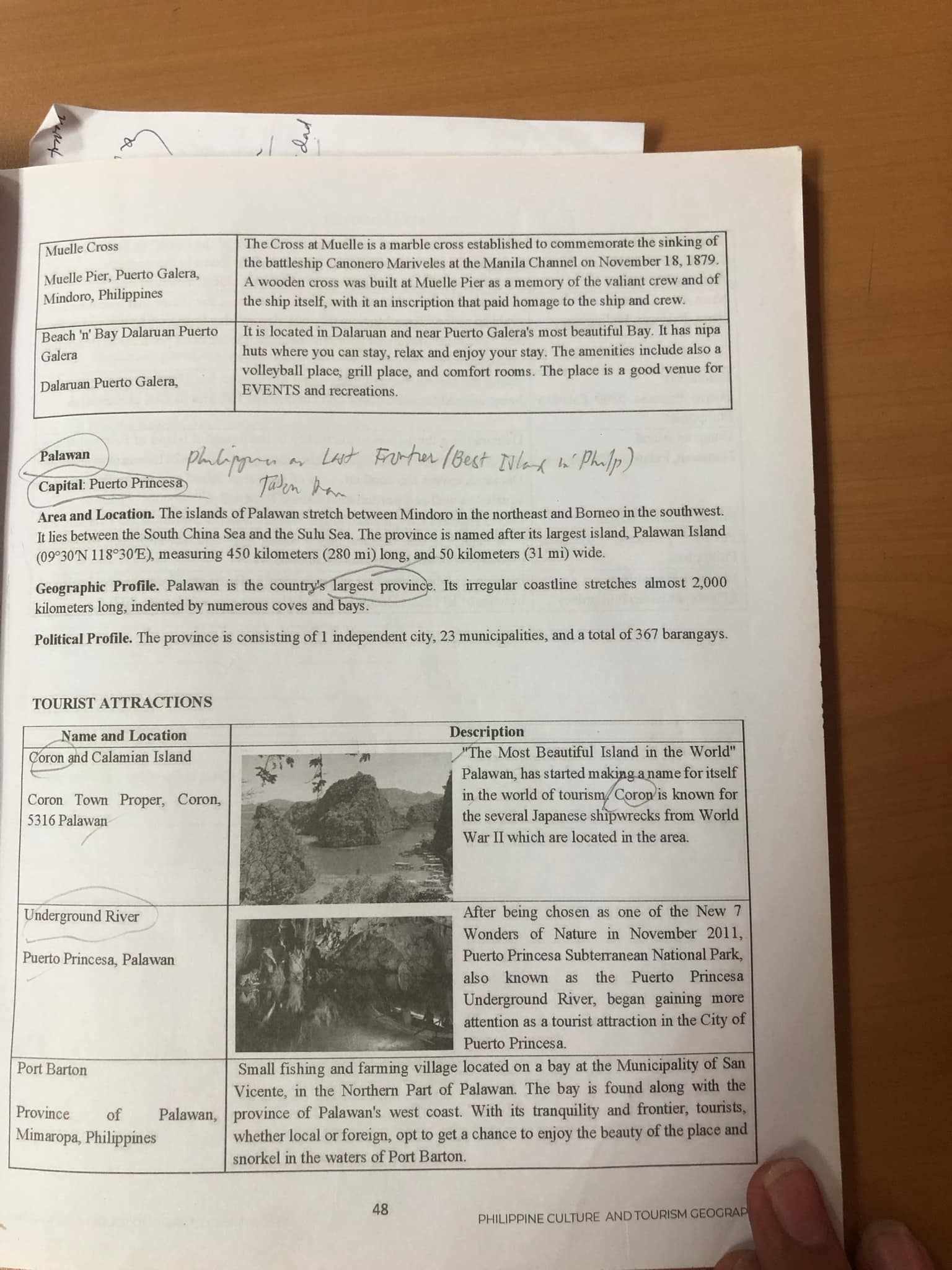
Overview
- Palawan is often referred to as the "Last Frontier" and recognized as one of the best islands in the Philippines. This showcases its stunning natural beauty and ecological significance.
Capital
- Puerto Princesa is the capital city of Palawan, serving as a gateway for tourists exploring the province's pristine landscapes and rich biodiversity.
Geography
- Location: The province lies between Mindoro to the northeast and Borneo to the southwest, bordered by the South China Sea and Sulu Sea. Its irregular coastline stretches almost 2,000 kilometers long and hosts numerous coves and bays, making it a haven for marine life and tourism.
Political Profile
- Administrative Structure: Palawan consists of 1 independent city (Puerto Princesa), 25 municipalities, and a total of 367 barangays, which facilitate local governance and community development.
Tourist Attractions
| Name and Location | Description |
|---|---|
| Coron and Calamian Island | Known as "The Most Beautiful Island in the World," Coron has made a name for itself in tourism, particularly famous for Japanese shipwrecks from World War II. |
| Underground River | Located in Puerto Princesa, this site was chosen as one of the New 7 Wonders of Nature in 2011. It highlights the Puerto Princesa Subterranean National Park and is a major tourist attraction in the city. |
| Port Barton | A small fishing and farming village located in San Vicente, Northern Palawan. Known for its tranquil waters, it is ideal for snorkeling and enjoying the natural beauty of the area. |
Additional Thoughts
- Ecotourism Potential: The unique geographic features and biodiversity offer significant opportunities for ecotourism, which can contribute to the local economy while promoting conservation efforts.
- Cultural Heritage: Palawan is home to various indigenous groups, adding cultural richness to its natural attractions, which can be an important aspect of tourist experiences.
- Sustainable Practices: With increasing tourist arrivals, there is a need to adopt sustainable practices to preserve Palawan's natural beauty and ecological integrity for future generations.
Reference:
www.tripadvisor.com
THE 15 BEST Things to Do in Palawan Island (2024) - Tripadvisor
www.palawan-philippines.com
Palawan Ecotourism
www.matchcollegiate.org
Ecotourism in a Hidden Paradise: El Nido, Palawan, Philippines
Tourist Attractions in Puerto Galera, Mindoro, Philippines
Summary
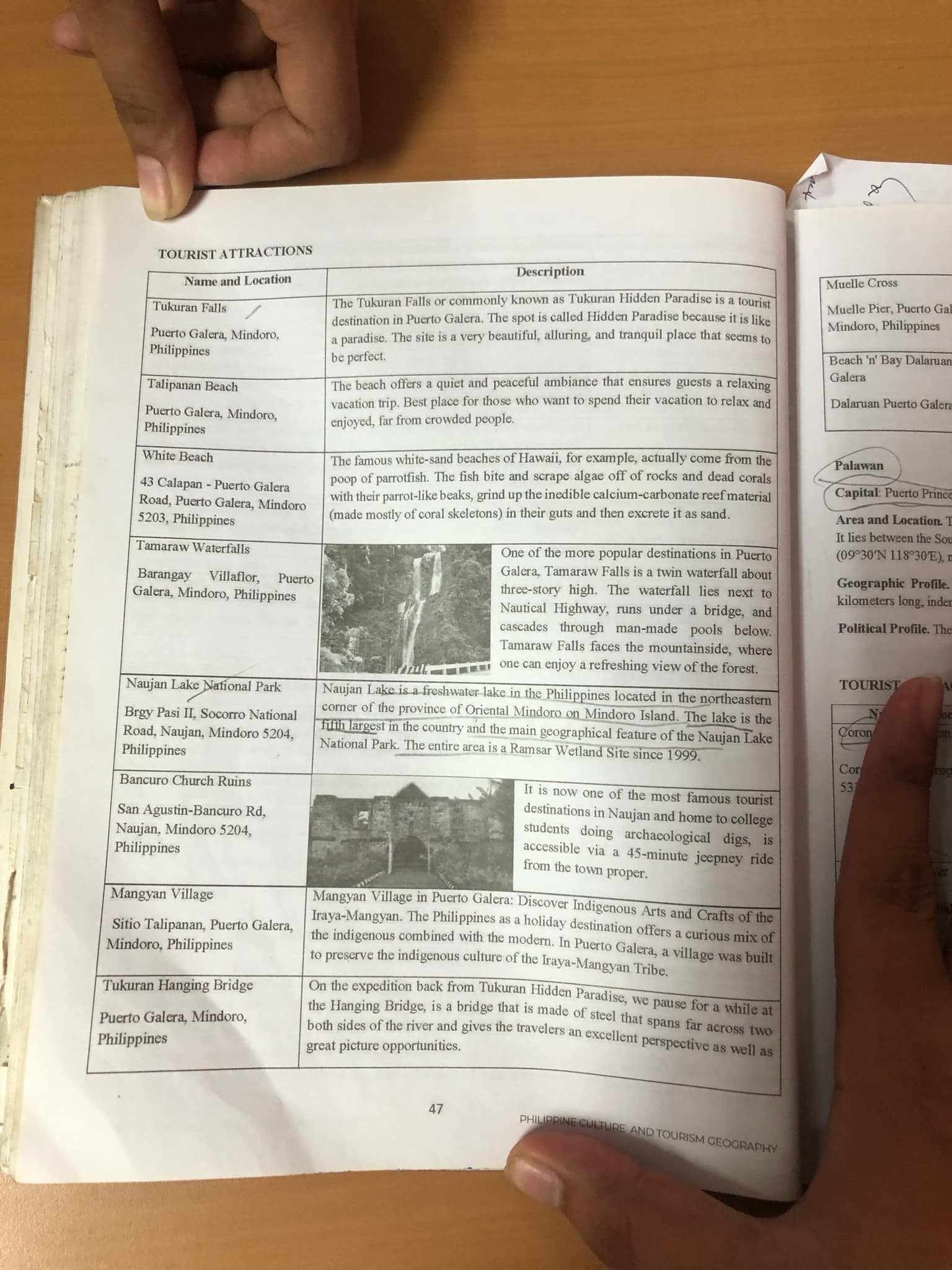
The image presents a list of tourist attractions in Puerto Galera and nearby areas, highlighting their unique features and descriptions. Puerto Galera is known for its natural beauty, serene beaches, and cultural experiences, making it a popular destination for travelers seeking relaxation and adventure.
Notes
Tukuran Falls
- Description: Known as Tukuran Hidden Paradise, this waterfall is a stunning tourist destination.
- Thoughts: It's a great spot for nature lovers and those looking for a tranquil getaway. The beauty of the site makes it an ideal place for relaxation and photography.
Talipanan Beach
- Description: Offers a peaceful atmosphere, perfect for vacationers to unwind.
- Thoughts: The serenity of the beach can provide a great escape from crowded places, allowing visitors to enjoy a quiet day by the water.
White Beach
- Description: Famous for its white sands reminiscent of Hawaii's beaches.
- Thoughts: This location is likely popular among tourists, especially for water sports and sunbathing, enhancing the overall experience of visitors.
Tamaraw Waterfalls
- Description: A three-story waterfall that is one of the popular destinations in Puerto Galera.
- Thoughts: The combination of natural beauty and adventure activities like hiking can attract both tourists and locals alike.
Naujan Lake National Park
- Description: A freshwater lake and significant geographical area in the region.
- Thoughts: The park's classification as a Ramsar Wetland Site indicates its ecological importance. It could be an excellent spot for eco-tourism and bird watching.
Bancuro Church Ruins
- Description: Historical ruins accessible to tourists interested in archaeology.
- Thoughts: These ruins could offer insights into the local culture and history, making it a worthwhile visit for history buffs.
Mangyan Village
- Description: A blend of indigenous arts and crafts in a village setting.
- Thoughts: This destination offers a unique cultural experience, allowing visitors to engage with the local community and explore traditional craftsmanship.
Tukuran Hanging Bridge
- Description: A bridge providing scenic views and photo opportunities.
- Thoughts: This spot can be ideal for adventurous travelers seeking to capture breathtaking views while enjoying the environment.
| Name and Location | Description |
|---|---|
| Tukuran Falls | Tourist destination known as Tukuran Hidden Paradise. |
| Talipanan Beach | Offers a relaxing ambiance for vacationing. |
| White Beach | Famous white-sand beaches reminiscent of Hawaii. |
| Tamaraw Waterfalls | A popular waterfall that cascades down from a three-story height. |
| Naujan Lake National Park | A significant freshwater lake and ecological area. |
| Bancuro Church Ruins | Historical ruins accessible for archaeological interest. |
| Mangyan Village | A destination showcasing indigenous arts and crafts. |
| Tukuran Hanging Bridge | A bridge offering great views and photo opportunities. |
Reference:
www.tripadvisor.com
Tamaraw Waterfalls - All You Need to Know BEFORE You Go (2024)
www.tripadvisor.com
THE 15 BEST Things to Do in Puerto Galera (2024) - Tripadvisor
guidetothephilippines.ph
Top 10 Things to Do in Puerto Galera: White Beach, Waterfalls ...
Notes on Oriental Mindoro and Tourist Attractions
1. Inasakan Beach
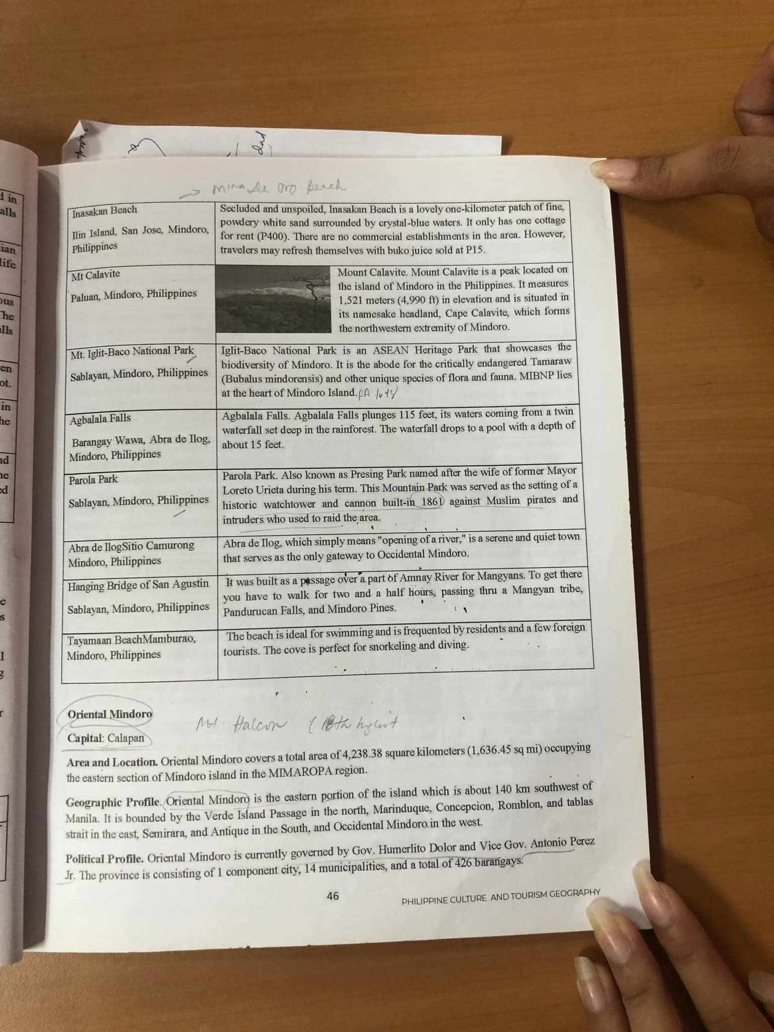
- Description: Inasakan Beach is a secluded one-kilometer stretch of powdery white sand, surrounded by crystal-clear waters.
- Thoughts: This makes it an ideal getaway for those looking for relaxation and natural beauty without commercial distractions.
- Additional Information: Only one cottage is available for rent, suggesting low human impact and preservation of the natural setting.
2. Mt. Calavite
- Description: Mount Calavite is a peak located on Mindoro Island, with an elevation of 1,521 meters (4,990 feet).
- Thoughts: Its significant height could provide unique ecosystems and biodiversity, possibly offering opportunities for hiking and nature studies.
- Additional Information: The mountain is part of the northern extremity of Mindoro, indicating its prominence in the region.
3. Iglt-Baco National Park
- Description: A national park that showcases the biodiversity of Mindoro and is an ASEAN Heritage Park.
- Thoughts: This designation highlights the park's importance in conserving critically endangered species.
- Additional Information: The park is the habitat of the Tamaraw and supports unique flora and fauna, emphasizing conservation efforts.
4. Agbalala Falls
- Description: The waterfalls plunge 115 feet into a pool with a depth of about 15 feet.
- Thoughts: The breathtaking views and serene environment can attract both tourists and local visitors interested in nature and photography.
- Additional Information: Waterfalls are often hotspots for eco-tourism, encouraging sustainable travel practices.
5. Parola Park
- Description: A park named after a historical figure that served as a lookout against pirates in the 1860s.
- Thoughts: The park's historical significance adds cultural value, providing insight into the area's past.
- Additional Information: It serves as a reminder of the region's need for protection against external threats, enriching the local heritage narrative.
6. Hanging Bridge of San Agustin
- Description: A passage over a part of the Amnay River used to connect different areas.
- Thoughts: Such structures often enhance connectivity and can be a focal point for community interactions.
- Additional Information: Walking across a hanging bridge can also be a tourist attraction, offering scenic views of the surrounding nature.
7. Tayamaan Beach, Mamburo
- Description: Ideal for swimming and snorkeling, frequented by both residents and tourists.
- Thoughts: The appeal of recreational activities makes it a popular destination for waterfront leisure.
- Additional Information: The presence of tourists can also contribute to local economic development through hospitality services.
Summary of Table Information
| Location | Description |
|---|---|
| Inasakan Beach | Secluded, one-kilometer beach with fine, powdery white sand. |
| Mt. Calavite | Peak located on Mindoro, reaching 1,521 meters in elevation. |
| Iglt-Baco National Park | Showcases biodiversity; home to endangered Tamaraw and diverse flora and fauna. |
| Agbalala Falls | Waterfalls plunge 115 feet into a pool, offering stunning natural views. |
| Parola Park | Historical park that served as a lookout against pirates in the 1860s. |
| Hanging Bridge of San Agustin | Passage over Amnay River that provides connectivity between areas. |
| Tayamaan Beach, Mamburo | Beach ideal for swimming and snorkeling, frequented by locals and tourists. |
General Information about Oriental Mindoro
- Capital: Calapan
- Area: Covers a total area of 4,238.38 square kilometers (1,636.45 sq mi) in the eastern section of Mindoro.
- Geographical Context: Bordered by Verde Island Passage and neighboring provinces, which provides strategic importance for trade and travel.
- Political Profile: Governed by Governor Humerlito Dolor and Vice Governor Antonio Perez Jr., consisting of 1 component city, 14 municipalities, and 426 barangays.
Reference:
philippinetourismusa.com
Oriental Mindoro: Culture, Traditions and Tourism | DOT
www.traveloka.com
Discover Oriental Mindoro's Tourist Spots and Must-Visit Places
www.travelorientalmindoro.ph
Attractions - | Travel Oriental Mindoro
Philippine Culture and Tourism Geography
Tourist Attractions in Cavinti and Occidental Mindoro
Key Attractions
-
Pagsanjan Falls and Rapids
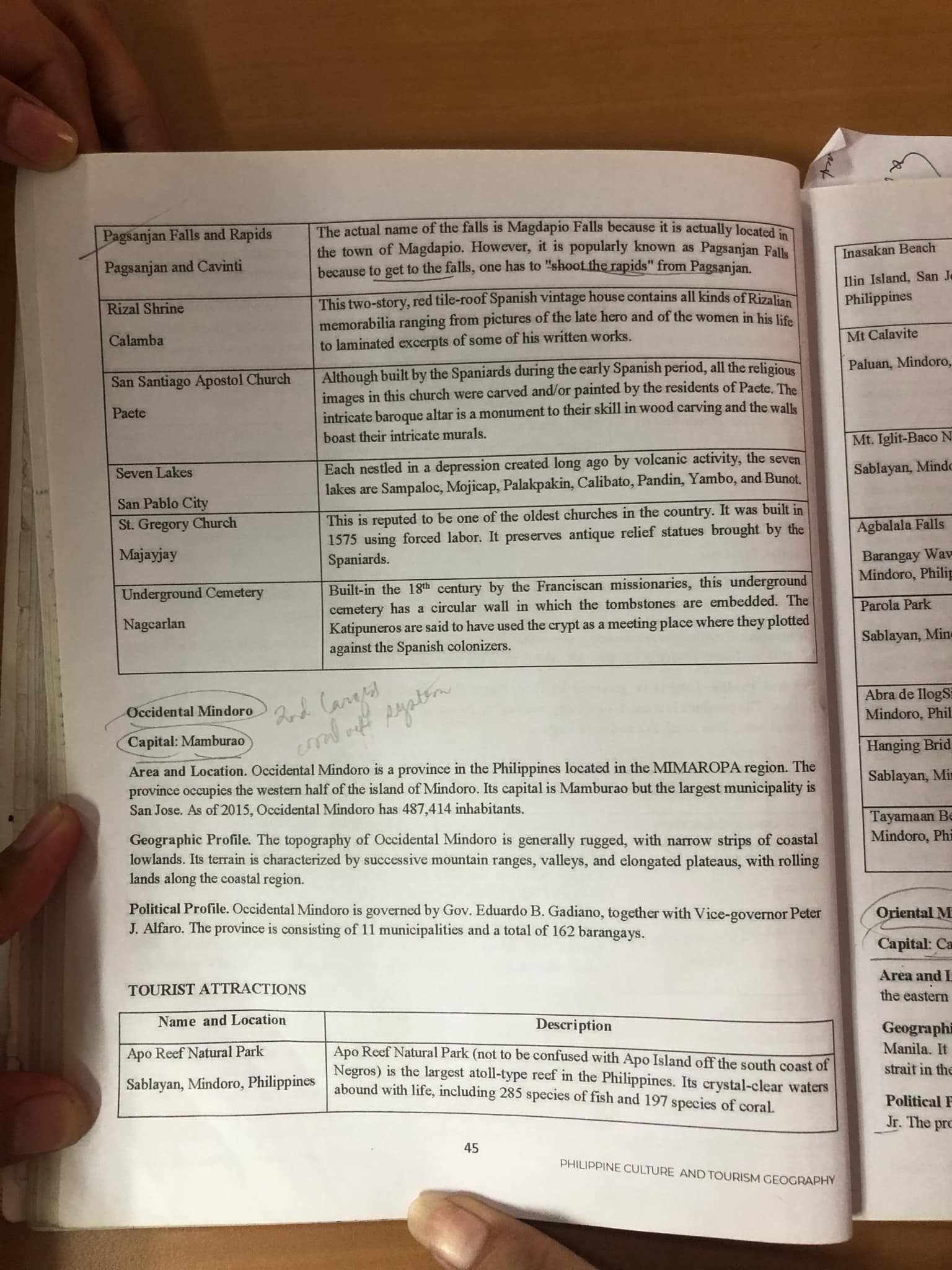
- Actual Name: Magdapio Falls
- Location: Town of Magdapio
- Description: Renowned for its scenic beauty, known for the adventure of "shooting the rapids" to reach the falls. This offers a unique experience for tourists, combining nature and adrenaline.
-
Rizal Shrine
- Description: A two-story, red tile-roof vintage house dedicated to the national hero, José Rizal. It showcases memorabilia related to his life, making it a significant historical site for both locals and tourists interested in Philippine history.
-
San Santiago Apostol Church
- Location: Paete
- Description: A historical church with rich baroque architecture, significant for both its artistic value and its historical roles during the Spanish colonization. It highlights the cultural heritage through its religious art and structure.
-
Seven Lakes
- Description: A unique geographical formation created by volcanic activity, featuring seven lakes with varying sizes and landscapes. Perfect for nature enthusiasts, the lakes are Sampaloc, Mojicap, Palakpakin, Calibato, Pandin, Yambo, and Bunot.
-
St. Gregory Church
- Location: Majayjay
- Description: Recognized as one of the oldest churches in the Philippines, built during a time of forced labor in 1575. It serves as a vital preservation site for Spanish colonial architecture.
-
Underground Cemetery
- Location: Nagcarlan
- Description: An underground cemetery built in the 18th century. It has a circular wall design that reflects the historical context of burial practices during Spanish rule, representing resistance against colonization.
Occidental Mindoro
-
Capital: Mamburao
-
Area and Location: Positioned in the MIMAROPA region, it includes the western half of Mindoro Island.
- Importance: The area is rich in biodiversity and natural resources, attracting eco-tourism.
-
Geographic Profile:
- Characteristics: Rugged terrain with coastal lowlands, featuring scenic landscapes ideal for various outdoor activities.
-
Political Profile: Governed by:
- Governor: Eduardo B. Gadiano
- Vice-Governor: Peter J. Alfaro
- Governance involves managing 11 municipalities and 162 barangays.
Tourist Attraction Table
| Name and Location | Description |
|---|---|
| Apo Reef Natural Park | The largest atoll-type reef in the Philippines, hosting rich marine biodiversity with 285 species of fish and 197 species of coral. |
| Sablayan, Mindoro, Philippines | Home to Apo Reef, recognized for crystal-clear waters and abundant marine life, making it a top destination for divers and nature lovers. |
Reference:
www.tripadvisor.com
THE 5 BEST Things to Do in Cavinti (2024) - Must-See Attractions
shoestringdiary.wordpress.com
Lubang Island: OksiMin's Enigmatic, Hidden Gem
kapampangantraveller.com
Discovering the Natural Wonder of Pagsanjan Falls (aka Cavinti Falls)
Philippine Culture and Tourism Geography - Laguna
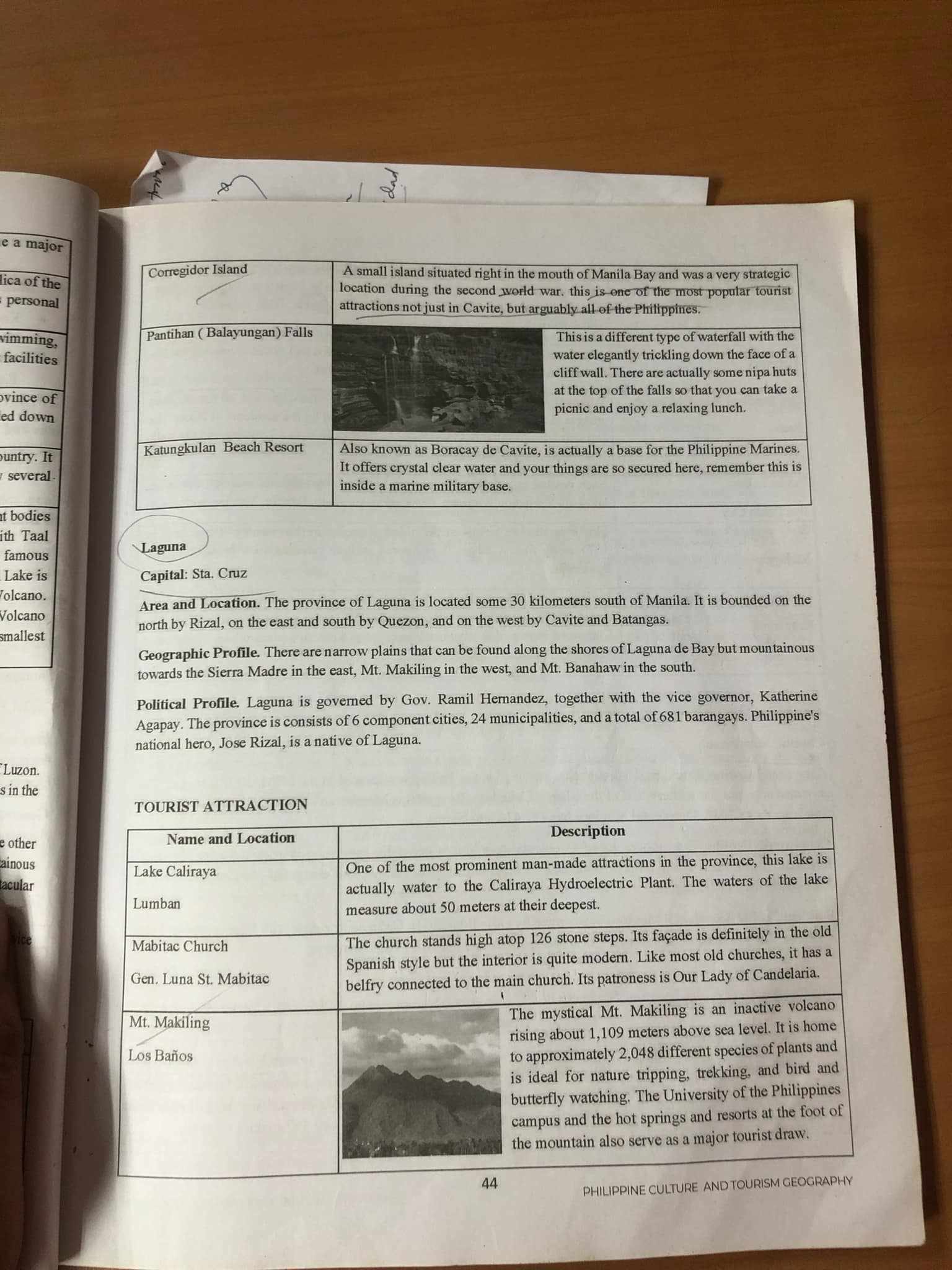
General Information
- Location: Laguna is located about 30 kilometers south of Manila. It is bordered by Rizal to the north, Quezon to the east, and Batangas to the west.
- Capital: Sta. Cruz
- Geographic Profile: The terrain includes narrow plains along the shores of Laguna de Bay, with mountains such as Mt. Makiling to the east and Mt. Banahaw to the south.
- Political Profile: Governed by Gov. Ramil Hernandez, the province comprises 6 cities, 24 municipalities, and 681 barangays. Notably, national hero Jose Rizal is from Laguna.
Tourist Attractions
| Name and Location | Description |
|---|---|
| Lake Caliraya, Lumban | One of the prominent man-made attractions, this lake is part of the Caliraya Hydroelectric Plant and measures around 50 meters at its deepest. Its development showcases the use of natural resources for energy generation, making it a significant example of sustainable development. |
| Mabitac Church | The church features 126 stone steps, with a façade reflecting old Spanish architecture, while its interior is modern. This mix illustrates the cultural evolution of religious sites in the Philippines, where historical significance merges with contemporary use. It’s dedicated to Our Lady of Candelaria, indicating the influence of Catholicism. |
| Mt. Makiling, Los Baños | An inactive volcano rising about 1,109 meters above sea level, it hosts around 2,048 different plant and animal species. This biodiversity highlights its ecological importance, making it ideal for activities like nature tripping and butterfly watching. The presence of educational institutions and hot springs in the area adds to its attraction as a tourist spot. |
Additional Thoughts
- Sustainable Tourism: These attractions reflect the delicate balance between economic development and ecological preservation. Promoting activities like nature trips can enhance local economies while encouraging conservation.
- Cultural Significance: The blend of historical and modern elements in places like Mabitac Church showcases the Philippines’ rich cultural heritage. The interaction between past and present can provide insight into the local community's values and traditions.
- Biodiversity: Mt. Makiling's status as a biodiversity hotspot underscores the importance of conservation efforts. Educational programs and eco-tourism initiatives can raise awareness and contribute to protecting these natural habitats.
Reference:
www.scribd.com
Chapter 1 - Philippine Tourism Geography and Culture | PDF - Scribd
www.researchgate.net
Plant Diversity of Mount Makiling Forest Reserve - ResearchGate
www.fao.org
Anmyeon-do Recreation Forest: a millenium of management
Philippine Culture and Tourism Geography Notes
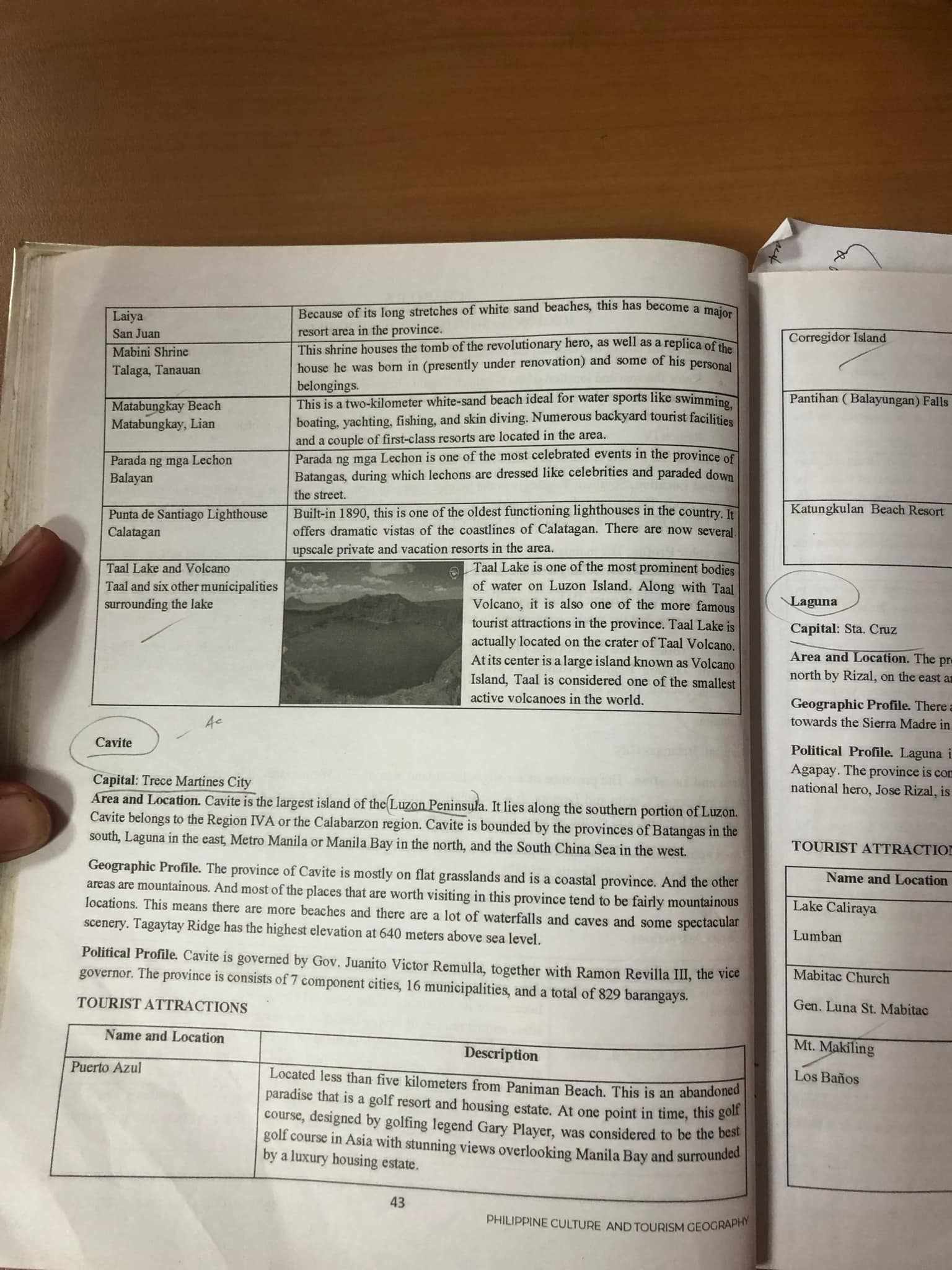
Tourist Attractions in Batangas and Cavite
Batangas
| Name | Description |
|---|---|
| Laiya, San Juan | Major resort area known for its long stretches of white sand beaches. Ideal for various water sports like swimming, yachting, and fishing. |
| Mabini Shrine | Contains the tomb of a revolutionary hero. A replica of his house is under renovation. |
| Talaga, Tanauan | Offers cultural and historical significance related to the local hero. |
| Matabungkay Beach | A beach ideal for water sports and known for backyard facilities for diving and fishing. |
| Parada ng mga Lechon | Celebrated event in Batangas featuring lechons dressed as celebrities parading down the street. |
| Punta de Santiago Lighthouse | One of the oldest lighthouses in the country, built in 1890. Offers stunning views of Calatagan's coastline. |
| Taal Lake and Volcano | Prominent tourist attraction and notable for its small active volcano located on Taal Island. |
Cavite
| Name and Location | Description |
|---|---|
| Puerto Azul | Located near Paniman Beach, it is an abandoned resort with a golf course built by Gary Player. |
General Information about Cavite
- Capital: Trece Martires City
- Area and Location: Cavite is the largest island in the Luzon Peninsula, bordered by various provinces and the South China Sea.
- Geographic Profile: Predominantly mountainous with notable waterfalls and caves.
- Political Profile: Governed by Juanito Victor Remulia; consists of 7 component cities, 16 municipalities, and 829 barangays.
Additional Thoughts
- Batangas is known for its diverse natural attractions catering to both adventure seekers and those looking for relaxation.
- Cavite's geographical features make it a popular destination for ecotourism, with opportunities for hiking and exploring waterfalls.
- The cultural significance of each attraction often ties back to local heritage and historical events, enhancing the visitor's experience.
Reference:
www.tripadvisor.com
THE 5 BEST Batangas Province Cultural Tours (with Prices)
www.britannica.com
Cavite | Historic Sites, Beaches, Resorts | Britannica
guidetothephilippines.ph
Top 23 Must-Visit Historical Places & Landmarks in the Philippines
Southern Tagalog Region Overview
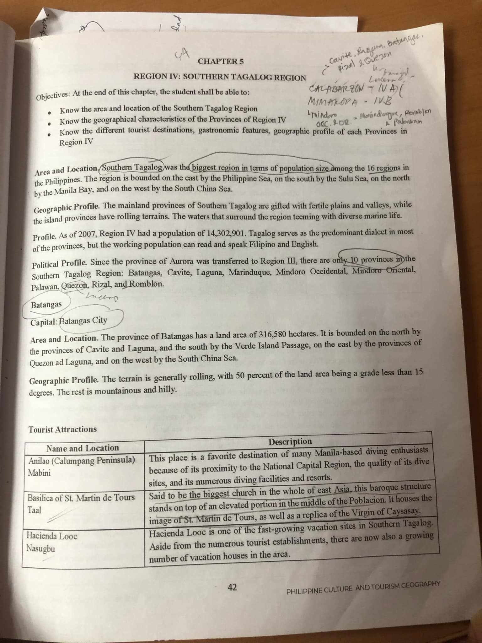
Objectives
- Understand the area and location of the Southern Tagalog Region.
- Recognize the geographical characteristics of the Provinces in Region IV.
- Identify various tourist attractions and features of Region IV.
Area and Location
- Southern Tagalog is the largest region in the Philippines based on population size, bordered by:
- East: Philippine Sea
- South: Sulu Sea
- North: Manila Bay
- West: South China Sea
Thoughts:
- The strategic location of Southern Tagalog plays a crucial role in its development and accessibility to both local and international tourism.
Geographic Profile
- The mainland provinces are characterized by fertile plains and valleys, with rolling terrains.
- As of 2007, Region IV had a population of 14,302,901. Tagalog is widely spoken, along with Filipino and English.
Additional Information:
- The diverse landscapes contribute to the rich agricultural production, which can attract eco-tourism activities.
Political Profile
- Since the reorganization, the region consists of 10 provinces, including:
- Batangas
- Cavite
- Laguna
- Marinduque
- Mindoro Occidental
- Mindoro Oriental
- Palawan
- Quezon
- Rizal
- Romblon
Batangas City
- Area and Location:
- Land area: 316,580 hectares.
- Bordered by:
- North: Cavite and Laguna
- South: Verde Island Passage
- East: Quezon and Laguna
- West: South China Sea
Thoughts:
- Batangas serves as a significant entry point for tourists due to its accessibility, particularly for those from Manila.
Geographic Profile of Batangas
- The terrain is generally rolling, with 50% of the land having a grade less than 15 degrees.
- The remaining land is mountainous and hilly.
Additional Information:
- The hilly terrains provide opportunities for outdoor activities and adventure tourism.
Tourist Attractions
| Name and Location | Description |
|---|---|
| Anilao (Calumpang Peninsula) | A popular destination for diving enthusiasts, noted for its proximity to Manila and quality of dive sites. |
| Basilica of St. Martin de Tours (Taal) | Recognized as the largest church in East Asia, known for its baroque architecture and historical significance. |
| Hacienda Looc (Nasugbu) | A rapidly growing tourist site with numerous vacation houses and facilities catering to leisure activities. |
Thoughts:
- These attractions not only highlight the cultural heritage of the region but also promote sustainable tourism by emphasizing local resources and experiences.
Additional Information:
- Increasing investments in tourism infrastructure can further enhance these attractions and the overall experience for visitors.
Reference:
www.audleytravel.com
Visit Southern Luzon in the Philippines | Audley Travel US
www.tripadvisor.com
THE 15 BEST Things to Do in Calabarzon Region (2024) - Tripadvisor
www.coursehero.com
SOUTHERN TAGALOG REGION.docx - PHILIPPINE CULTURE ...